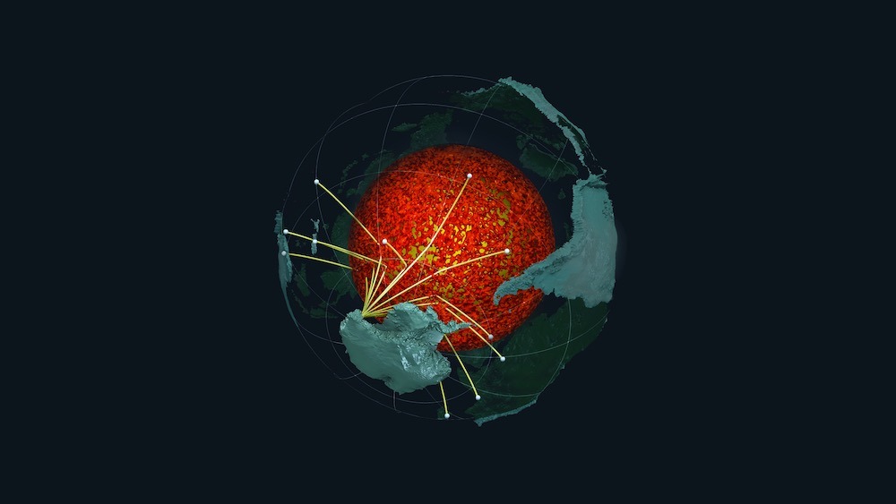
A massive ocean floor lurks near Earth’s core. Now, seismic imaging has revealed that it likely surrounds much — if not all — of the core.
This thin, dense layer is lodged roughly 2,000 miles (3,200 kilometers) below Earth’s surface, between the core and the planet’s middle layer, called the mantle. And it might encompass the entire core-mantle boundary, according to a study published April 5 in the journal Science Advances (opens in new tab).
To study Earth’s interior, seismologists measure earthquake waves that zoom through the planet and then back out to Earth’s surface. By seeing how these waves change after passing through the different structures inside Earth, researchers can create a map of what Earth’s innards look like. Past research identified a handful of isolated pockets of dense ocean crust near the core. These pockets are called ultra-low-velocity-zone structures (ULVZs) because seismic waves travel very slowly through them.
“Only [approximately] 20% of the core-mantle boundary has been previously investigated for ULVZs, which have not been identified in all of these locations,” lead study author Samantha Hansen (opens in new tab), an associate professor of geological sciences at The University of Alabama, told Live Science in an email. “It is possible that this anomalous material covers the entire core.”
In the new study, scientists placed seismic equipment at 15 stations located across Antarctica and collected data for three years.
Related: 450-mile-wide solid metal ball forms Earth’s innermost core, earthquake waves reveal
This study marks the first time that high-resolution imaging of the core-mantle boundary was made using data from the Southern Hemisphere. The layer itself is razor-thin compared with the core, which is 450 miles (724 km) across, and the mantle, which is roughly 1,800 miles (2,900 km) thick.
“The thickness does vary, depending on location,” Hansen said, with some spots measuring about 3.1 miles (5 km) thick and others 31 miles (50 km) in thickness.
This ancient ocean layer likely developed when Earth’s tectonic plates shifted, causing oceanic material to be carried into the planet’s interior at subduction zones, the areas where two plates collide and force one to dip beneath the other. Over time, “accumulations of subducted oceanic material collect along the core-mantle boundary and are pushed by the slowly flowing rock in the mantle,” according to a statement (opens in new tab).
Researchers think the newly detected ULVZs are essentially “underground mountains” that allow heat to escape from Earth’s molten core, according to the statement.
“The presence of this layer could buffer heat flow across the core-mantle boundary, which is important because the temperature conditions in this portion of the Earth have been shown to strongly impact the planet’s magnetic field,” Hansen said.
Chunks of this hidden ocean floor may also get swept up into mantle plumes — hot, upwelling jets of molten rock that fuel volcanic hotspots at the surface, such as in Hawaii, Hansen suggested.
“Further, since mantle plumes are largely controlled by the thermal conditions near the core-mantle boundary, the temperature influence of ULVZs may help dictate where plumes form,” Hansen said.
The research team plans to expand their study by examining data collected from all available seismic stations in Antarctica.
Stay connected with us on social media platform for instant update click here to join our Twitter, & Facebook
We are now on Telegram. Click here to join our channel (@TechiUpdate) and stay updated with the latest Technology headlines.
For all the latest For Top Stories News Click Here
