Most of the ArkLaTex will experience some of the coldest air of the season Saturday night. The cold temperatures will hang around for more than a week. A cold rain will return Monday and Monday night and will be followed by rather dry conditions next week.
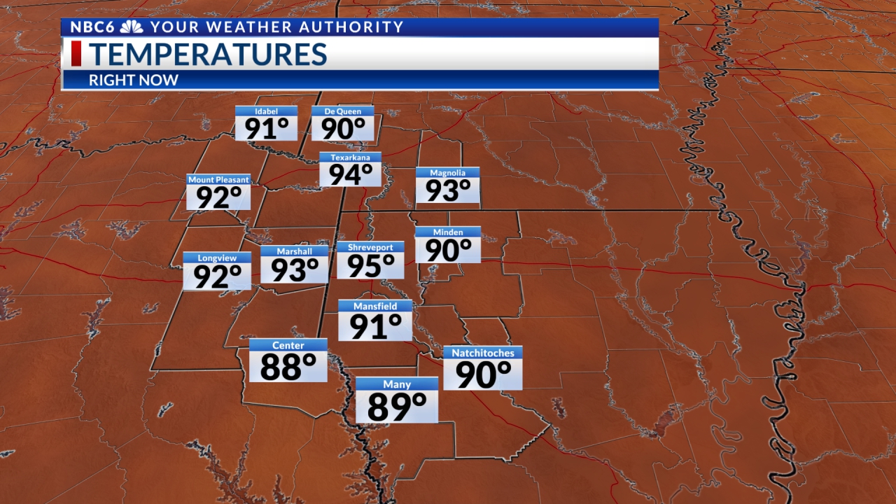
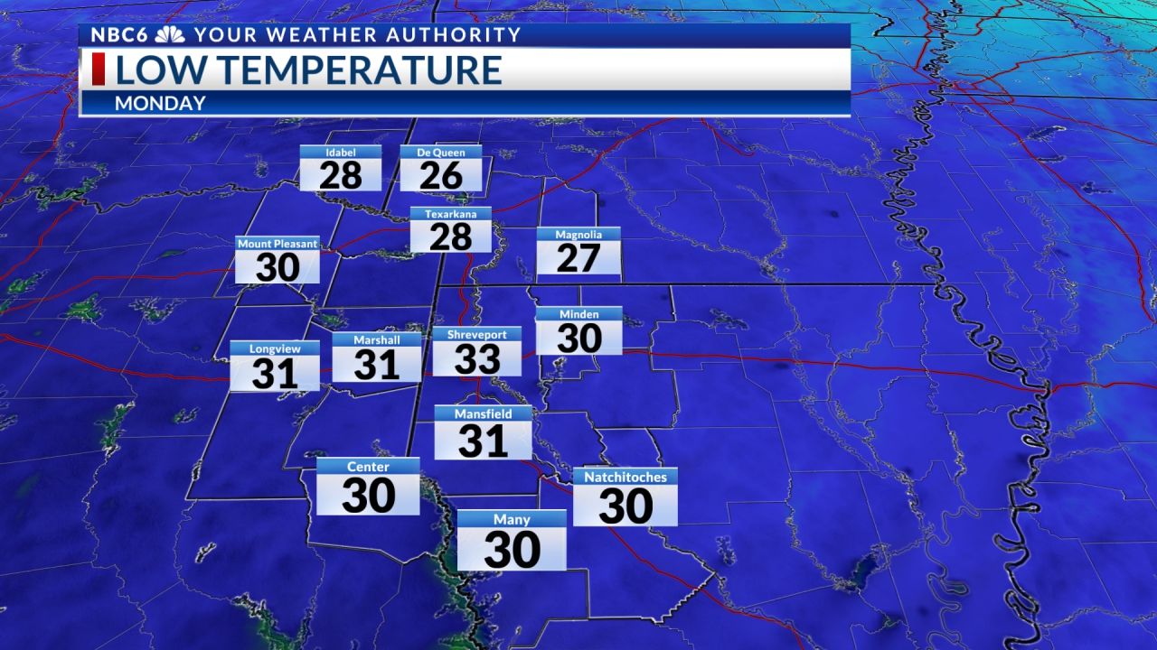
Freeze likely Saturday night: Saturday night will likely be the coldest of the season so far as temperatures across the ArkLaTex will dip into the mid to upper 20s over the northern half of the area and the upper 20s to lower 30s over the south. Temperatures Sunday will be very similar to what we have experienced today. Look for highs over most of the area to return to the low to middle 50s. This is well below normal for this time of year. Typically, highs are in the upper 60s. Normal lows for this time of November are in the middle 40s.
Sunny end to the weekend: Futurecast shows that we will see a clear sky over the area Sunday night. Expect plenty of sunshine to return Sunday. Sunday night will begin clear, but we will likely see clouds invade the area from the south and west late. Our next disturbance will move into the area Monday. Rain will likely begin over the western half of the area Monday morning. It will reach its peak late Monday afternoon and early evening. It will then end from west to east Monday night. We will likely be stuck with plenty of clouds both Monday night and Tuesday. Thanks to the rain Monday and the clouds Tuesday. Highs on both days will likely be in the upper 40s to lower 50s.
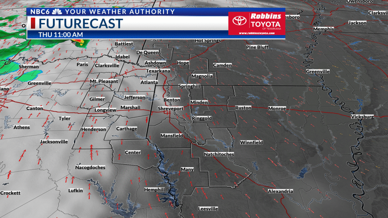
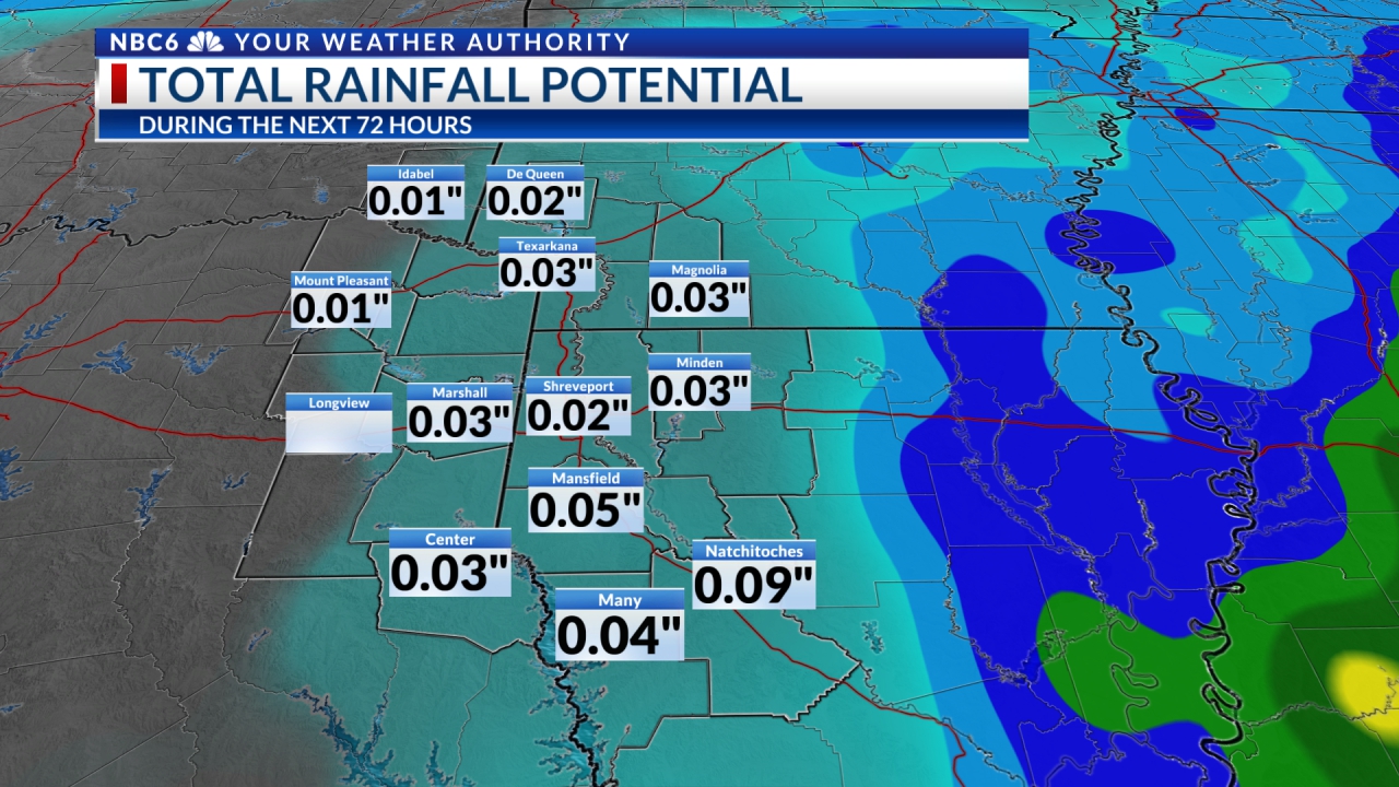
How much rain: We shouldn’t have any issues with Monday’s disturbance. Severe weather is highly unlikely and the rain shouldn’t be heavy enough to cause any flooding concerns. Futurecast shows that most of the area will see ½ to 1” of rain with isolated higher amounts.
An extended period of chilly temperatures: It still appears that it will be well more than a week before temperatures get closer to normal. Highs next week will likely stay in the lower 50s for most of the week. Overnight lows will likely stay in the low to middle 30s. While we will see several disturbances that will reinforce this chilly air, the most consistent models show that we will likely not see rain for the rest of the week. Thanksgiving week will begin with a chance of rain next Monday & Monday night. After that, it is quite possible that temperatures will stay below normal through all of Thanksgiving week. Models that go out to Thanksgiving Day show a chance of rain with highs in the upper 50s to lower 60s. Of course, this is a long time from now and probably will change some.
Get daily forecasts and exclusive severe weather details on storms as they approach your area by downloading the Arklatex Weather Authority app now available in the App Store and Google Play
Stay connected with us on social media platform for instant update click here to join our Twitter, & Facebook
We are now on Telegram. Click here to join our channel (@TechiUpdate) and stay updated with the latest Technology headlines.
For all the latest For News Update Click Here