The chance of the scattered thunderstorm will stay in the forecast Wednesday. We will likely take a break from the rain threat Thursday and Friday with more rain to possibly return Saturday. The coolest air in months is possible next week.
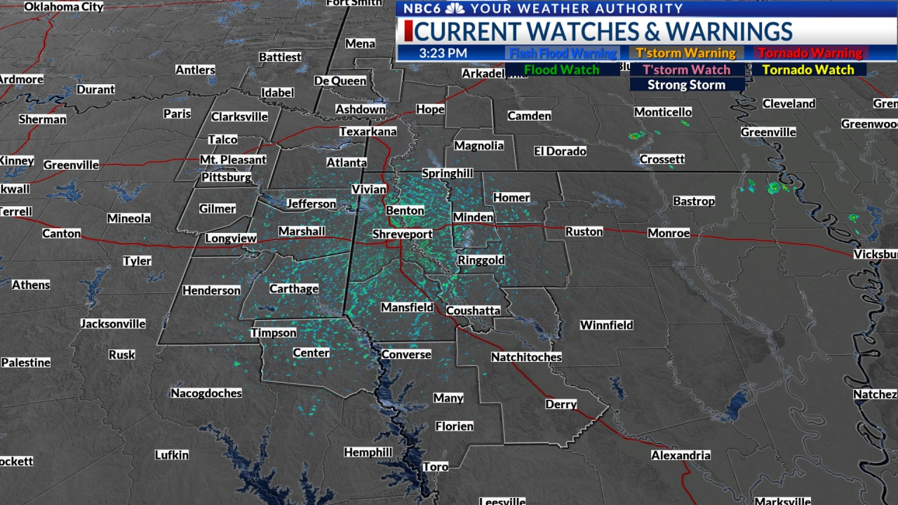
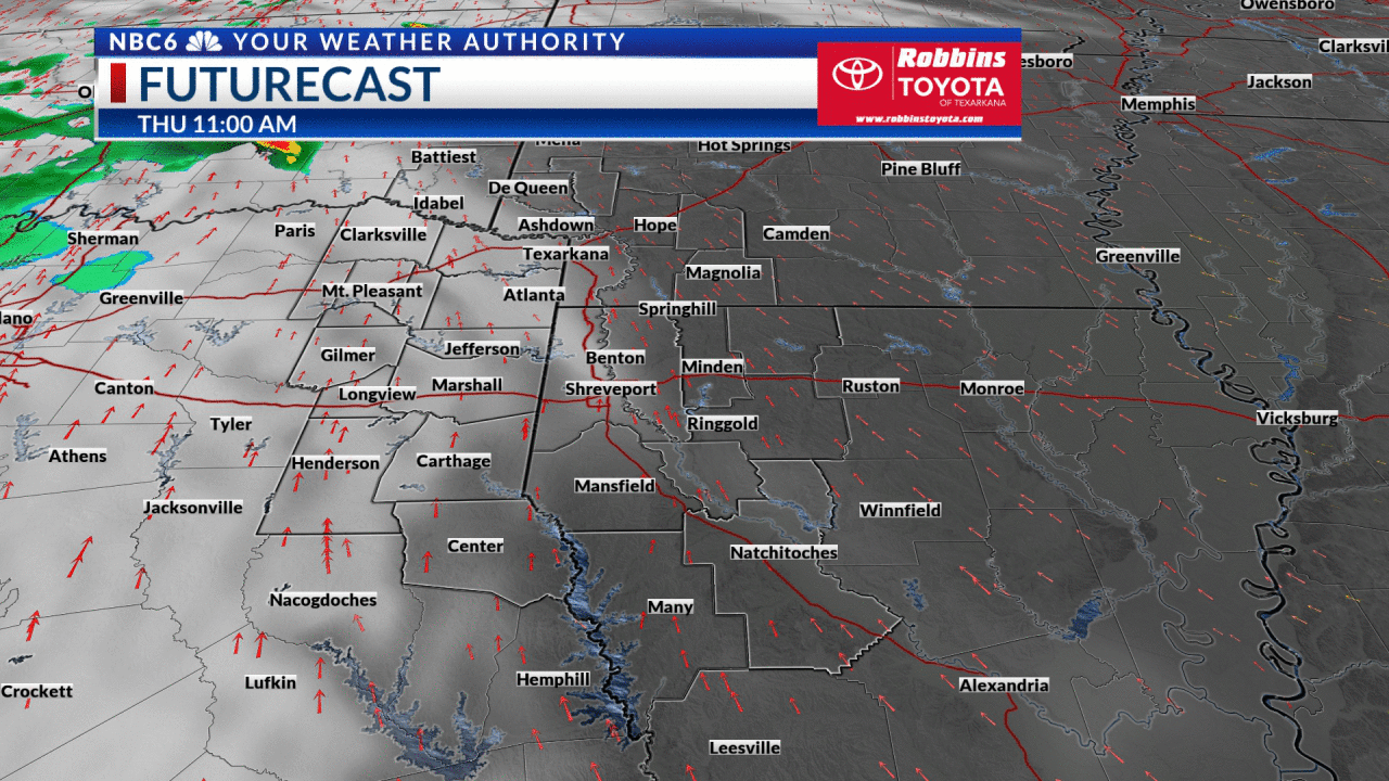
The threat of rain continues: Much of the ArkLaTex stayed dry on Labor Day with scattered showers and thunderstorms. We have seen a few areas of rain develop around the area today. Futurecast shows that the threat of scattered showers or thunderstorms will linger through Wednesday. Expect today’s rain to end this evening. New areas of rain could develop late Tuesday night over parts of the area. The coverage of the rain will likely increase some Wednesday before ending Wednesday evening. We will likely see a drier weather picture on both Thursday and Friday with a mix of sunshine and clouds. Rain will likely return to parts of the ArkLaTex on Saturday.
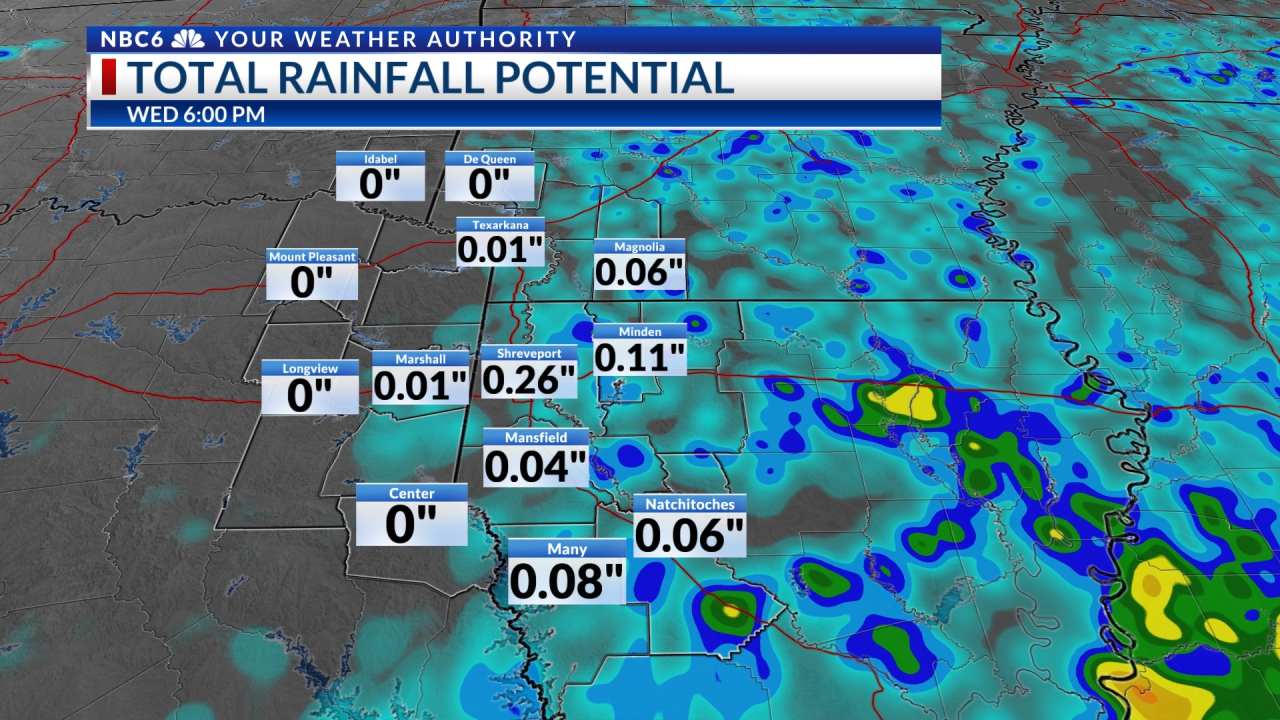
How much more rain? Futurecast shows that rainfall will be rather limited for most of the area as most locations will receive less than ¼” of rain. We will likely see scattered areas of heavier totals that could be in the ½ to 1” range. It looks like the best chance of seeing the heavier rain will be over East Texas and Northwest Louisiana.
Little change in daytime temperatures: Highs Tuesday have climbed into the upper 80s to lower 90s over most of the area. Thanks to more clouds and rain, Wednesday’s temperatures should be similar to Tuesday’s as most of the ArkLaTex will see highs in the upper 80s to lower 90s. These temperatures are a few degrees below normal for this time of year.

Is drier air finally on the way? The long-range weather picture is finally showing that a surge of drier air could invade the ArkLaTex next week. If things play out as models now indicate, we could consequently see some of the coolest air in our area in nearly three months as overnight lows could dip into the low to middle 60s. We likely won’t see much change in daytime temperatures as highs will stay in the mid to upper 80s through all of next week.
Get daily forecasts and exclusive severe weather details on storms as they approach your area by downloading the Arklatex Weather Authority app now available in the App Store and Google Play
Stay connected with us on social media platform for instant update click here to join our Twitter, & Facebook
We are now on Telegram. Click here to join our channel (@TechiUpdate) and stay updated with the latest Technology headlines.
For all the latest For News Update Click Here