After a very wet start to the day Saturday, we are now seeing a break in the rain. The rain has been in association with the remnants of Hurricane Ian. It is also very damp, cool and breezy. Temps have been hovering in the mid to upper 50s and will stay there for pretty much the next 24 hours.
CBS2
For Saturday night and early Sunday morning, it will be mostly cloudy with waves of showers at times. Damp and breezy conditions will prevail. Wind gusts will average between 10-20 mph, with higher gusts along the coast. Our low will be 56.
CBS2
Sunday looks to be nearly identical to Saturday, with some minor differences. Unlike Saturday, rain will be lighter overall and will persist from the late morning through the afternoon. Areas to the south and east of the city is where the rain will be most concentrated.
CBS2
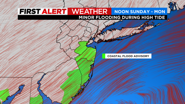
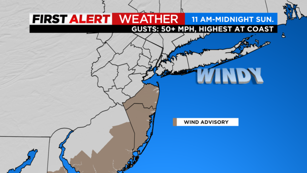
Winds will also be higher than Saturday, with some gusts reaching 40 mph, especially for coastal New Jersey. The winds may lead to some coastal flooding, and therefore a coastal flood advisory and a wind advisory have been issued in these areas. We will struggle to reach the 60-degree mark, with a high of only 59.
CBS2
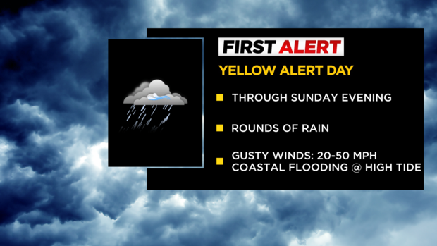
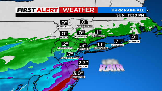
Regarding rainfall totals for the period, forecast models have come down considerably from where they were Friday. Now it appears that the majority of the region will see additional rain totals averaging around a quarter of an inch, while coastal New Jersey may see totals well over an inch. A Yellow Alert is in place through Sunday.
Stay connected with us on social media platform for instant update click here to join our Twitter, & Facebook
We are now on Telegram. Click here to join our channel (@TechiUpdate) and stay updated with the latest Technology headlines.
For all the latest Entertainment News Click Here