Morning! We’re waking up to temps in the 60s around the area for most… some 50s to the north and west. It’s another dry start and that’ll continue all day.
CBS2
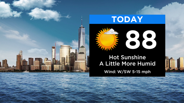
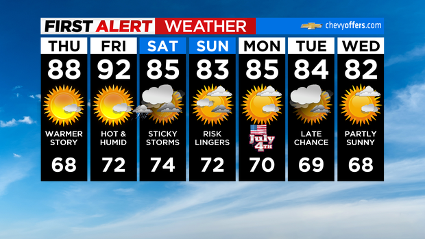
Expect plenty of sunshine with highs a bit warmer, climbing into the upper 80s and low 90s. The humidity will be up some today, but still not at all bad for the last day of June.
CBS2
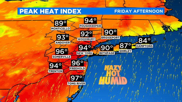
Friday is when you’ll really start feeling it as most of us get into the 90s and dew points rise well into the 60s. It’ll be a hazy, hot, and humid finish to the week with mostly sunny skies. By late afternoon and especially into the evening, some showers and thunderstorms will likely pop, mainly to the west.
CBS2
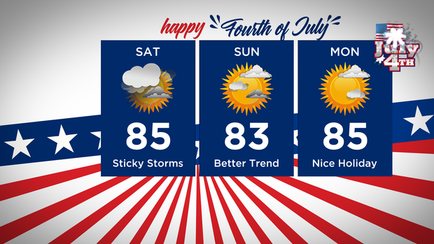
That activity will move eastward overnight and into Saturday as a cold front slowly drifts closer. For now, Saturday is looking like the wettest part of the holiday weekend. It won’t be raining all day but expect passing showers and thunderstorms at any time.
CBS2
By Sunday, the best risk moves south of the city and much of the region should see improving conditions. The fourth itself is looking like the best of the 3. Highs will be in the 80s through the weekend.
Stay connected with us on social media platform for instant update click here to join our Twitter, & Facebook
We are now on Telegram. Click here to join our channel (@TechiUpdate) and stay updated with the latest Technology headlines.
For all the latest Technology News Click Here