It’s been a quiet night but things will take a stormy turn as we go through the rest of the day and maybe into the evening hours. It appears that a strong upper-level trough of low pressure will be well to our northeast. However, there will be an attendant cold front that will stretch southwestward through the Central Plains into Texas. This cold front is inching closer to the ArkLaTex this morning and we will be watching for showers and thunderstorms developing to our northwest. The storms may congeal into a possible complex as they spread southeast but could remain as a line preceding the cold front.
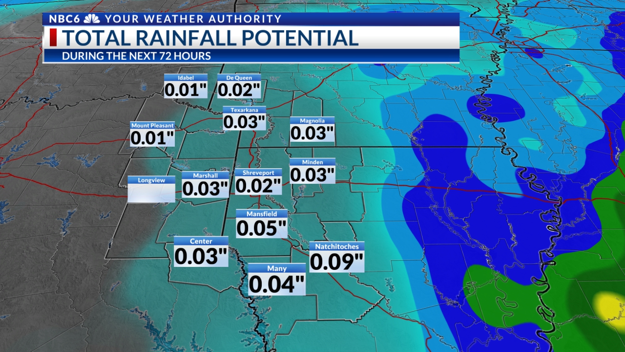
The Storm Prediction Center has a Slight Risk (2/5) of severe storms for the NW half of the ArkLaTex with a Marginal Risk (1/5) to the SE. The main threat will be damaging winds and possibly hail. Heavy downpours will also be possible. There may be some lingering rain late tonight into early Saturday before high-pressure moves in.

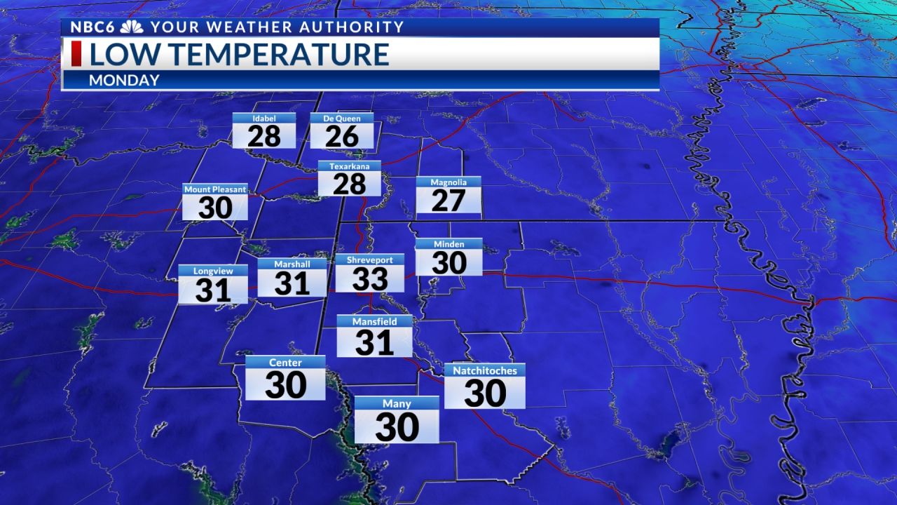
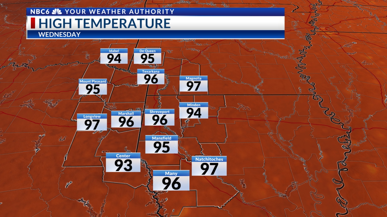
We will likely see a very nice period of cooler weather for quite a while. Afternoon high temperatures will be in the 80s to near 90° Friday falling into the mid to upper 70s by Sunday with a modest rise next week. Morning lows will be in the 60s to near 70° Saturday morning falling to either side of 60° Sunday through Tuesday with a modest rise the rest of the week. It appears there could be minor changes over the next seven days that may bring slight chances for rain.

Stay connected with us on social media platform for instant update click here to join our Twitter, & Facebook
We are now on Telegram. Click here to join our channel (@TechiUpdate) and stay updated with the latest Technology headlines.
For all the latest For News Update Click Here