Deserts and mountains of Southern California and southern Nevada are expected to be hit hardest by heavy rain as Hurricane Hilary weakens into a tropical storm.
Hilary may be coming in a little faster than initially expected. Tropical-storm-force winds — sustained winds of at least 39 mph — were forecast to arrive in San Diego County as early as Sunday morning.
Across Southern California, officials are particularly concerned about Sunday afternoon and evening.
Hilary’s track has shifted slightly eastward. The risk for coastal flooding in L.A. County has perhaps dropped, but flooding risks inland still remain significant, and especially dangerous in the deserts and mountains.
Here is a breakdown of what to expect on Sunday:
Size and speed
Hilary is a big storm, roughly the size of the state of Arizona. As expected, on Sunday morning, Hilary weakened from a hurricane to a tropical storm, but still had powerful maximum sustained winds of 70 mph and still represented a significant flooding threat.
Areas of concern
Rain and flooding is the biggest risk from Hilary, with particular risk in the deserts and mountains. Already, roads have turned into rivers in Baja California, forecasters said, and the storm is expected to have similar impacts in some places here.
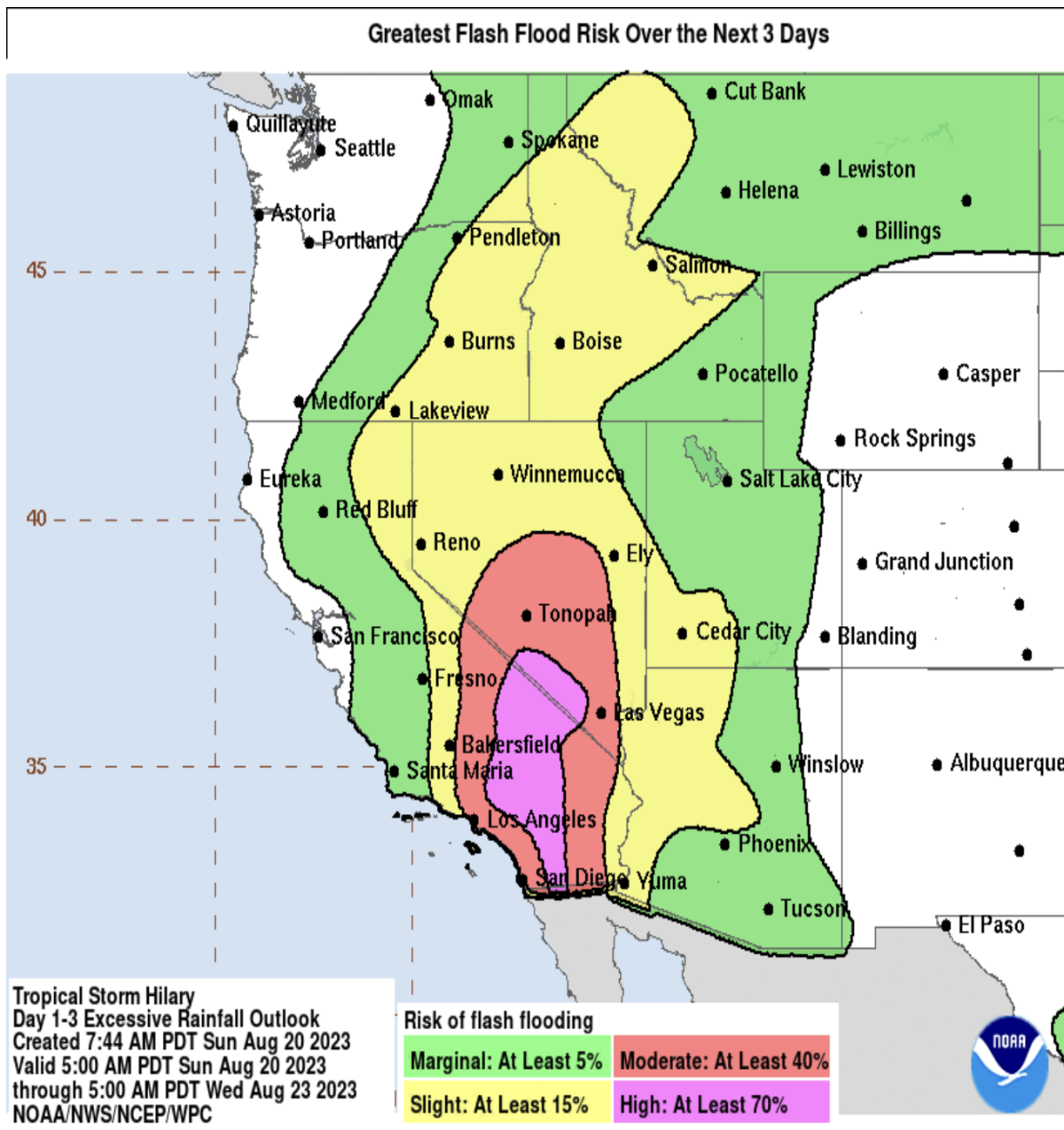
- Forecasters warn there could be historic flood impacts, especially for San Bernardino and Inyo counties, with Death Valley and Morongo Basin expected to see the most major flooding.

Areas with greatest flash flood risk over the next three days.
(National Hurricane Center)
- Roads could be closed in Death Valley and Highway 62, which runs along the northern edge of Joshua Tree National Park.
- In Los Angeles County, the area of overall highest risk will be in areas like the San Gabriel Mountains and the Antelope Valley, where there is high risk for dangerous and damaging floods on roads, creeks and in neighborhoods. The rain could also trigger landslides, debris flow, mud flows and rock slides; some buildings could face shallow flood waters.
Rain intensity
Some rain rates could exceed one inch per hour, even up to 1.5 inches per hour. A couple of projections show up to 2 inches per hour, forecasters said. Rain rates of 1.5 inches per hour is torrential rain, which can result in catastrophic flooding over a desert, mountain or valley.
A year ago, Death Valley saw 1.7 inches of rain during “unprecedented rains” — what was the rainiest day on record — causing major floods and forcing the closure of all roads in the park, according to the National Park Service.

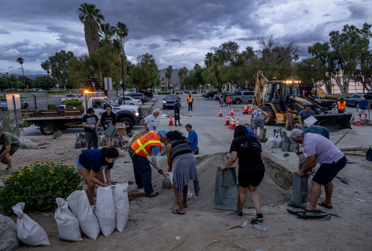
Palm Springs residents quickly fill sandbags as storm clouds approach.
(Gina Ferazzi / Los Angeles Times)
Some desert areas in Southern California could see a year’s worth of rain in as little as a 24-hour period. The rain won’t be constant, but could involve several rounds of heavy rainfall.
For the duration of the storm, Palm Springs could see 4 to 5 inches of rain in the next few days, and Joshua Tree National Park, between 5 to 7 inches — as much rain as these areas get in a year.
Flash flooding is likely along the California-Arizona border, including Parker, Blythe, and Yuma, forecasters said.
Coast
Compared to the deserts and mountains, along the coast, rain from Hilary won’t be as extreme, but will still be high. Anaheim, Irvine and San Clemente could see up to 2.5 inches of rain, and San Diego up to 2 inches of rain.
Basin and inland
In L.A. County, Lancaster and Acton could see 4 inches of rain; Santa Clarita, Pasadena and Northridge, around 3 inches of rain; and downtown L.A., Long Beach, Redondo Beach, Pomona and Westlake Village, around 2 inches of rain.

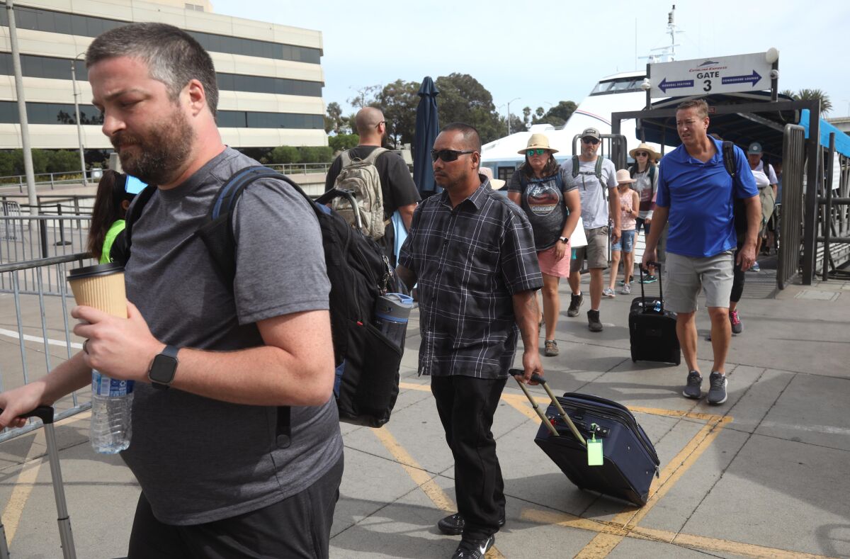
Evacuees from Catalina Island arrive in Long Beach ahead of Hilary.
(Genaro Molina / Los Angeles Times)
Catalina
Catalina expected to experience dangerous sea conditions within its harbors at Avalon and Two Harbors. Officials on Saturday moved to evacuate residents.
Beyond
Bakersfield could see up to 2 inches of rain; Santa Barbara, less than 1 inch of rain; and San Luis Obispo, one-tenth of an inch.
Other factors
WINDS could be strong enough to cause power outages and cause trees to fall.
Most likely, significant winds will increase Sunday morning, peaking Sunday afternoon and decreasing Sunday night into Monday.
Peak wind gusts could hit as high as 81 mph at Joshua Tree National Park and 67 mph in Wrightwood. Peak gusts could hit 62 mph in Anaheim, 60 mph in Irvine, 58 in Palm Springs and Ontario, 54 in Big Bear Lake, 52 in Riverside, 46 in San Clemente, 43 in San Diego and 41 in San Bernardino.
In Los Angeles County, probable peak wind gusts could be 44 mph in Santa Clarita and Lancaster, 40 in Northridge and Westlake Village, 35 in Avalon on Catalina Island, 32 in Pomona, 31 in Pasadena, 30 in Long Beach, 29 in downtown Los Angeles and 26 in Redondo Beach.

Shelves are nearly empty of bottled water in a grocery store as people stock up.
(Mario Tama / Getty Images)
THE EYE of Hilary is expected to cross onto land in Mexico, around Ensenada, and then head north just east of Tijuana and San Diego.
It’s expected to be over the Riverside and Victorville areas by Sunday evening, and by midnight Monday morning, would be in the Mojave Desert moving north. It’s forecast to largely follow the Owens Valley going northward, just east of the U.S. 395 corridor — essentially east of Ridgecrest, Bishop and Mammoth Lakes.
There’s still a chance the storm track could move farther east, or head back west.
THUNDERSTORMS AND LIGHTNING are possible. There’s a 20% to 30% chance of thunderstorms, which will enhance the risk of flash flooding.
AIRPORTS will likely have delays or cancellations. Los Angeles International Airport should expect a wind from the east, which typically causes major delays. Palm Springs International Airport said Southwest Airlines has canceled all fights in and out of that airport through Monday morning.
TORNADOES are a low probability, but remain possible. Tornadoes are somewhat common from tropical systems, and even if they do arise, they usually don’t stick around for long.
WAVES will be highest on south-facing beaches. Orange County beaches could see wave heights between 6 to 12 feet; San Diego County, 3 to 5 feet.
COASTAL FLOODING risk exists but is considered low for the Long Beach area, including Belmont Shores, and Catalina Island. If the Hilary continues on its currently projected path, the risk of coastal flooding is probably going to be minor. But if Hilary veers westward, risk of coastal flooding along the L.A. County coast will increase.
STAY OFF THE ROADS if you can, especially Sunday afternoon and night. “Postpone travel unless absolutely necessary,” the California Highway Patrol said. But if you must, don’t drive through flooded areas or make abrupt lane changes, and bring an emergency kit with water, food, blankets, a flashlight and first aid supplies.
HISTORICAL CONTEXT: The last time Long Beach saw significant coastal damage from a hurricane was from Marie in 2014. Hurricane Marie remained well offshore but nonetheless caused nearly $16 million in damage in and around the Port of Long Beach, broke through a major breakwater and caused at least $3 million in damage in Catalina Island, a federal report said.
Death Valley saw significant damage from floods just last August. Unprecedented rains brought 1.7 inches of rain to Death Valley on Aug. 5, 2022, which broke the record for the rainiest day at the Furnace Creek weather station, the National Park Service said. It sent severe flash floods across the park and forced all roads there to close. Death Valley typically receives 2.2 inches of rain in an entire year.
The last tropical storm to cross into California was Nora in 1997, according to the National Hurricane Center, which weakened into a tropical depression several hours after its arrival. It crossed into the U.S. along the California-Arizona border.
A better-known tropical storm hit Southern California in 1939, dumping more than 5 inches of rain on L.A. in 24 hours; a National Weather Service document called that storm “El Cordonazo,” or “The Lash of St. Francis.”
That 1939 storm crossed from ocean to land at San Pedro and resulted in 45 deaths in floods across Southern California, and 48 at sea. The eastern Coachella Valley was flooded with two feet of water. The fact that Californians were so unprepared for that storm led what was then called the Weather Bureau to open a forecast office in Southern California, which began operations in 1940, the document said.
Stay connected with us on social media platform for instant update click here to join our Twitter, & Facebook
We are now on Telegram. Click here to join our channel (@TechiUpdate) and stay updated with the latest Technology headlines.
For all the latest Hollywood News Click Here
