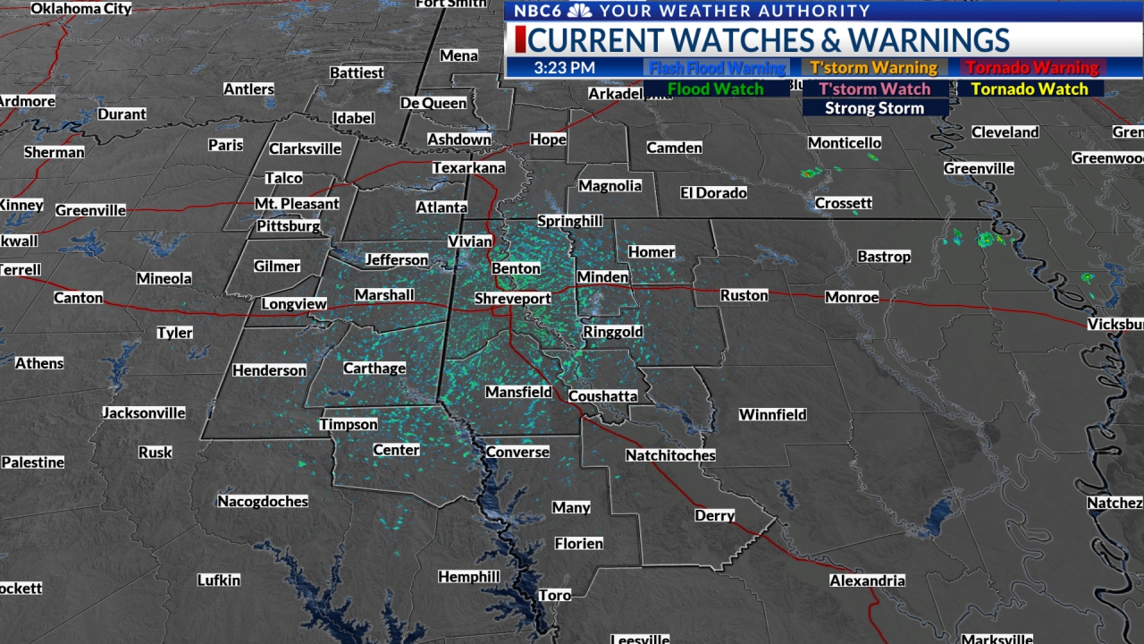
A cold front will move through the ArkLaTex Friday night bringing a good chance for severe weather to the area. All severe weather threats will be possible including a few tornadoes. Sunshine and cooler air briefly return this weekend. A Tornado Watch is already in effect for the NW edge of the ArkLaTex until 8 pm.
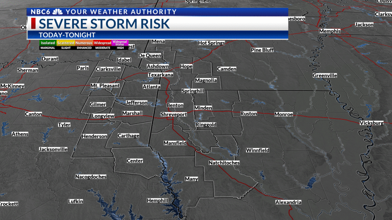
A stormy Friday night: Thunderstorms will move across all of the ArkLaTex Friday night bringing the threat of severe weather. Damaging straight-line wind gusts of 60-70 mph will be possible in spots and will cause the most widespread issues. A few tornadoes are also very possible with a strong tornado possible over the western half of the area. Up to half-dollar-sized hail will also be possible. The hail threat will likely be highest over the western half of the area. Below are the latest outlooks from the Storm Prediction Center. As of this writing, it shows a moderate risk for the northwestern quarter of the ArkLaTex and an enhanced risk for the rest of the area. The moderate risk means that our chance of severe weather is a 4 on a scale of one to five.
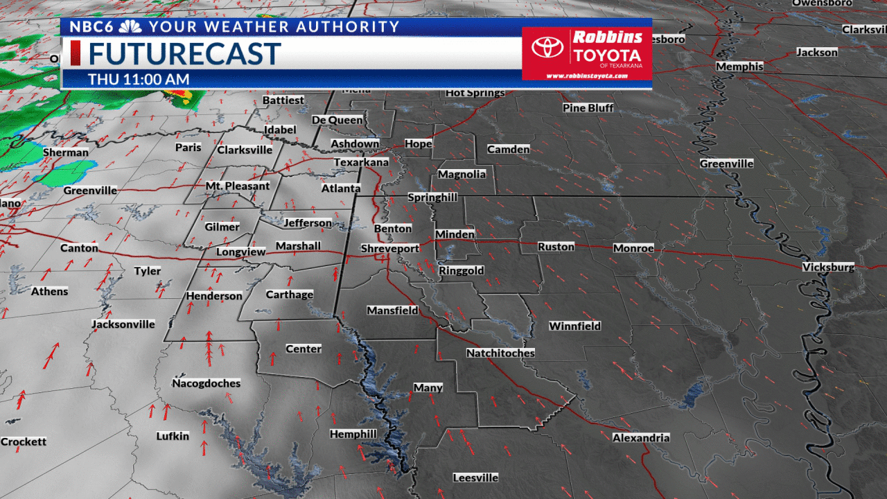
Storm timing: Futurecast shows that a line of storms will develop to the west of our area Friday afternoon. This line will move into the NW edge of our area late Friday afternoon or early Friday evening. If the timing of Futurecast is correct, the line will move into Texarkana between 9 pm and 10 pm and into Shreveport between 10 pm and 11 pm. We should exit the southeast corner of the ArkLaTex between 1 am and 3 am. Keep in mind that this applies to the timing of the line. Discrete cells that develop ahead of the line could arrive in spots sooner. Look for the clouds to quickly give way to sunshine for most of Saturday. The quiet weather will stick around through the weekend with a few more clouds in the mix Sunday.
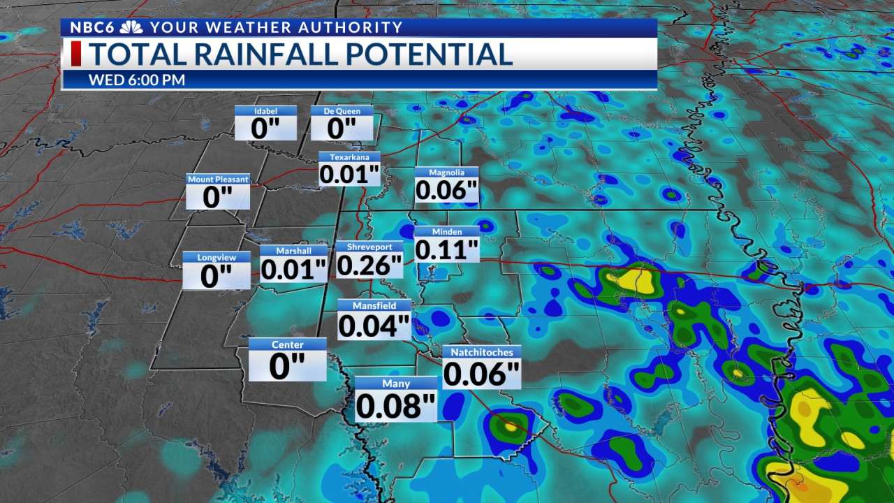
Heavy rain possible: Models continue to show a decent amount of rain will fall on the ArkLaTex as the front rolls through. The line of storms could accelerate as it moves through our area. This acceleration would mean that the highest rainfall totals will likely fall over the NW half of the area where the rain could last longer. These areas will likely see 1.5 to 2” with isolated reports of over 2”. Amounts over the SE half of the area where the rain will exit quicker will probably see totals of around 1”. Flooding will likely not be much of an issue with the rainfall totals expected.
Quiet next week: Dry weather should return for most of next week with only a slight chance of rain Sunday night and Monday. Next week will begin with highs in the upper 70s to low 80s. The warmer temperatures will likely stick around through the first half of next week. By the end of the week, we will see some much cooler air return. The arrival of the cooler air could squeeze out a little rain next Friday. Highs will likely dip into the 50s and low 60s by next weekend. Overnight lows will dip into the mid to upper 30s.
Get daily forecasts and exclusive severe weather details on storms as they approach your area by downloading the Arklatex Weather Authority app now available in the App Store and Google Play
Stay connected with us on social media platform for instant update click here to join our Twitter, & Facebook
We are now on Telegram. Click here to join our channel (@TechiUpdate) and stay updated with the latest Technology headlines.
For all the latest For News Update Click Here