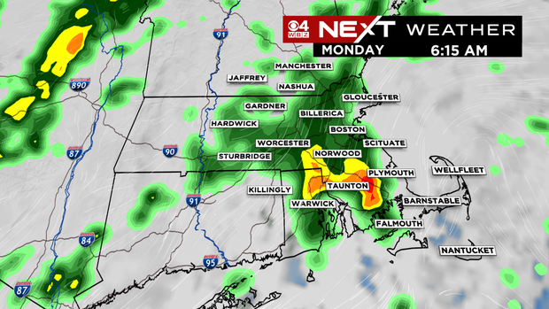
BOSTON — After a fantastic stretch of days, Sunday has seen some changes. Rain arrived from south to north, overspreading the area through the afternoon. Some towns on the Cape and Islands have already picked up between a half and a full inch of rain. Impressive stuff!
More rain is expected through Monday, and though it won’t be a complete wash-out, having the rain gear at the ready would be recommended. Isolated downpours and even some storms will be around during the morning commute, midday, and afternoon. Any rain will hold temperatures in check with highs topping out near 60°.
CBS Boston Graphic
Tuesday looks mainly dry with just some very isolated passing showers. Highs spike back to near 70°. If you’re looking for some dry time over the next three days, Tuesday is your best bet.
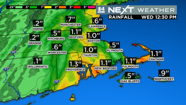
We’re not done with the rain just yet. Another round of heavy downpours will swing through on Wednesday morning. The best chance for these showers will be inside of 495 and towards the Cape. Areas inland like Worcester County may miss some of the heavier Wednesday rains.
When the unsettled stretch finally ends, some may have picked up between 1-3″ of rain.
CBS Boston Graphic
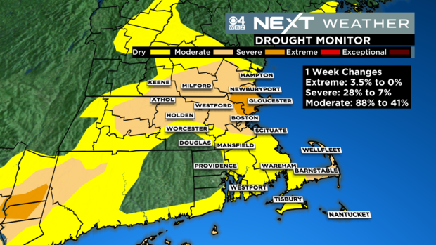
It’s worth noting that we’ve made huge strides in our drought situation over the past month or so, and this rain will no doubt continue that trend.
CBS Boston Graphic
Cooler air spills in for Halloween weekend, but as of right now, we’re looking mainly dry.

Stay connected with us on social media platform for instant update click here to join our Twitter, & Facebook
We are now on Telegram. Click here to join our channel (@TechiUpdate) and stay updated with the latest Technology headlines.
For all the latest Entertainment News Click Here