As California’s wet winter has given way to warmer spring weather, the state’s record snowpack has begun to melt.
Though the accumulated snow still measures 249% of normal as of April 18, new satellite photos show that the white blankets enveloping mountains across the state have started to recede.
The Southern Sierra continues to be the standout region, with snow levels on slopes there at more than 300% of normal.
Satellite images seen below from NASA’s Earth Observing System Data and Information System, or EOSDIS, show the snowy Sierra on March 16 (left), and a month later (right).
While the snow pack remains substantial in the more recent image , it has dissipated significantly at lower elevations. The Mendocino Range, seen in the top left of the image, also shows significant snow loss.
In Southern California, the change has been even more dramatic.
The San Gabriel, San Bernardino and San Jacinto mountains were blanketed in snow on March 24, but by April 8 much of the snow had melted away.
Images below from a European Space Agency satellite captured the snow melt.
While the Southern California snowpacks have caused relatively little flooding as they melt, the snow in the Sierra may be a different story.

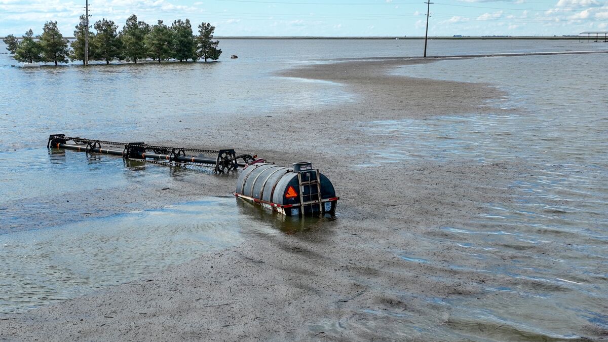
Farm equipment stands in floodwater just South of Tulare River Road.
(Robert Gauthier / Los Angeles Times)
Flood danger could last through the year in the adjacent San Joaquin Valley, officials told the Times. The valley has already endured significant flooding this year, with excessive rains wreaking havoc in small towns and fueling the renaissance of Tulare Lake.

Tulare Lake continues to rise along its northern border.
(Robert Gauthier / Los Angeles Times)
Typically, about a quarter of snow melt takes place in April, with the majority coming in May and June as the weather warms up.
But the remarkably wet winter means flooding could linger through much of the year, the latest outlooks show.

View from aboard a whitewater raft during a tour of the upper Kern River in Kernville.
(Jack Dolan / Los Angeles Times)
The Tulare Lake basin and the San Joaquin River basin remain the areas of top concern, as record-deep snowpack in the southern Sierra Nevada is expected to send a cascade of water down into the San Joaquin Valley as it melts.

Isabella Lake as seen from Wofford Heights on April 7, 2023.
(Myung J. Chun / Los Angeles Times)
The threat comes after one of the state’s coldest, wettest winters on record. Mammoth Mountain in the Sierra received more than 700 inches of fresh powder this season, and there is now more water contained in the state’s snowpack than the capacity of Lake Mead, the nation’s largest reservoir.
Stay connected with us on social media platform for instant update click here to join our Twitter, & Facebook
We are now on Telegram. Click here to join our channel (@TechiUpdate) and stay updated with the latest Technology headlines.
For all the latest Fashion News Click Here
