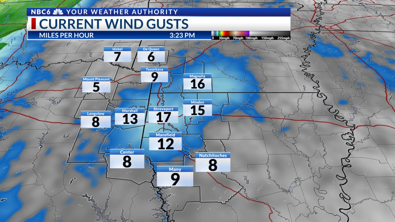
It has been a very windy Wednesday and abundant moisture is still surging into our area. The wind will continue to be from the south at 10 to 15 mph. Wind gusts could be 25+ mph. The mid and upper levels of the atmosphere will find moisture increasing, as well. This is thanks to a very strong southwest flow in the upper atmosphere. At this time, there is a surface high-pressure system to our east and low pressure at the surface to our west. And we will add to the mix, a warm front surging northeast across our area as we speak. There is an outside chance that scattered showers may develop overnight.
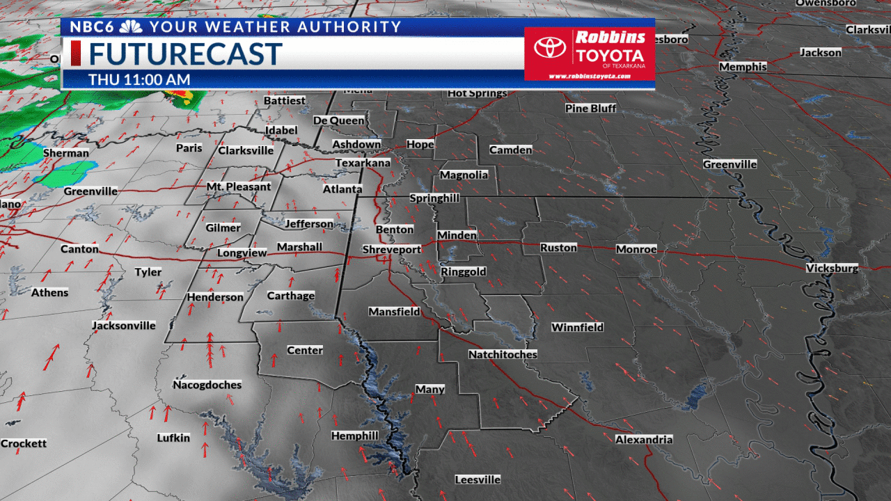
It goes without saying, that our chilly temperatures of late will be left in the dust. As we look ahead at the next few days, our morning low temperatures will be in the 50s to near 60°. Afternoon high temperatures will be in the 60s and 70s through the New Year weekend. As far as the storms that we are expecting, they may be increasing to our west by midday Thursday as a disturbance moves into our area. A stronger surge of storms will be found by mid-afternoon into the overnight hours as a very strong trough of low pressure enters the area from the west.
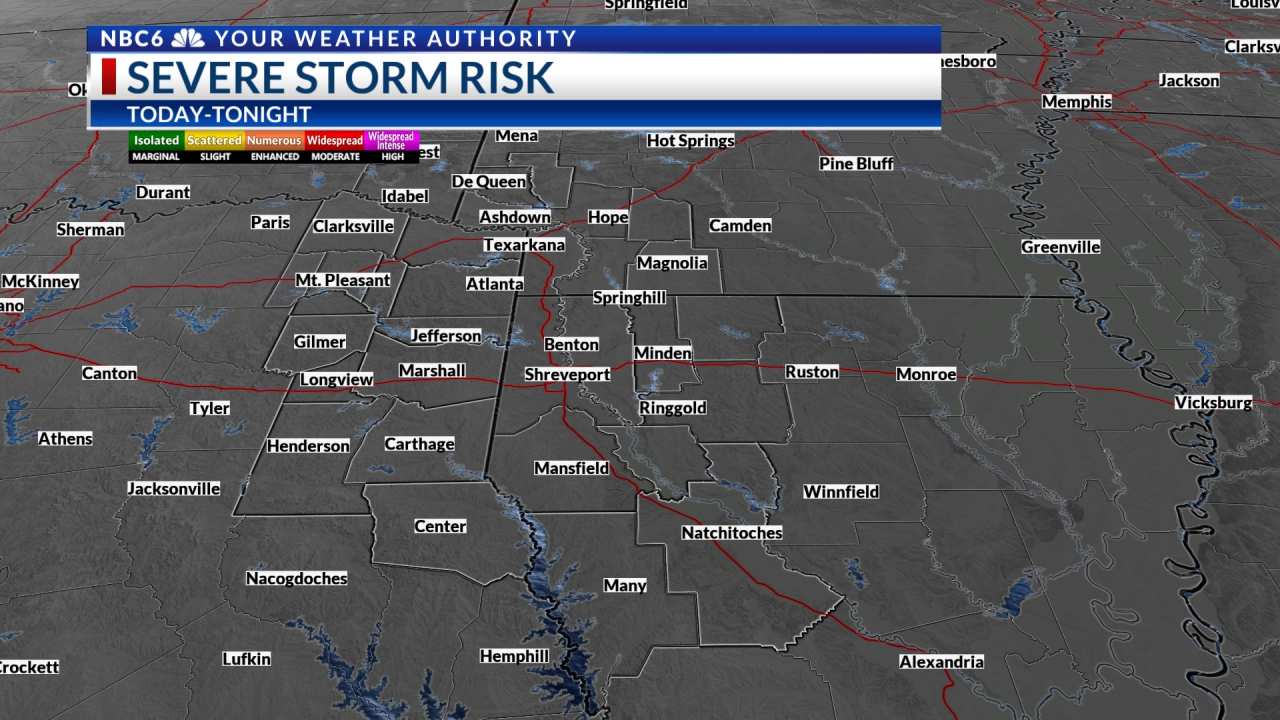
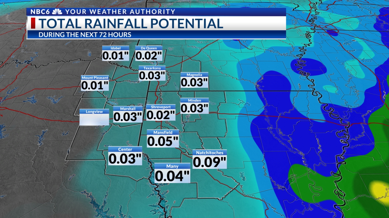

There is a Marginal Risk (the lowest risk) of severe storms with damaging wind gusts. Of more concern will be heavy rainfall from late Thursday into early Friday. At this time there are no watches. However, this will be monitored closely. The good news is that the New Year weekend will be rain-free and unusually warm. By the way, the first Monday of 2023 will be stormy.
Stay connected with us on social media platform for instant update click here to join our Twitter, & Facebook
We are now on Telegram. Click here to join our channel (@TechiUpdate) and stay updated with the latest Technology headlines.
For all the latest For News Update Click Here