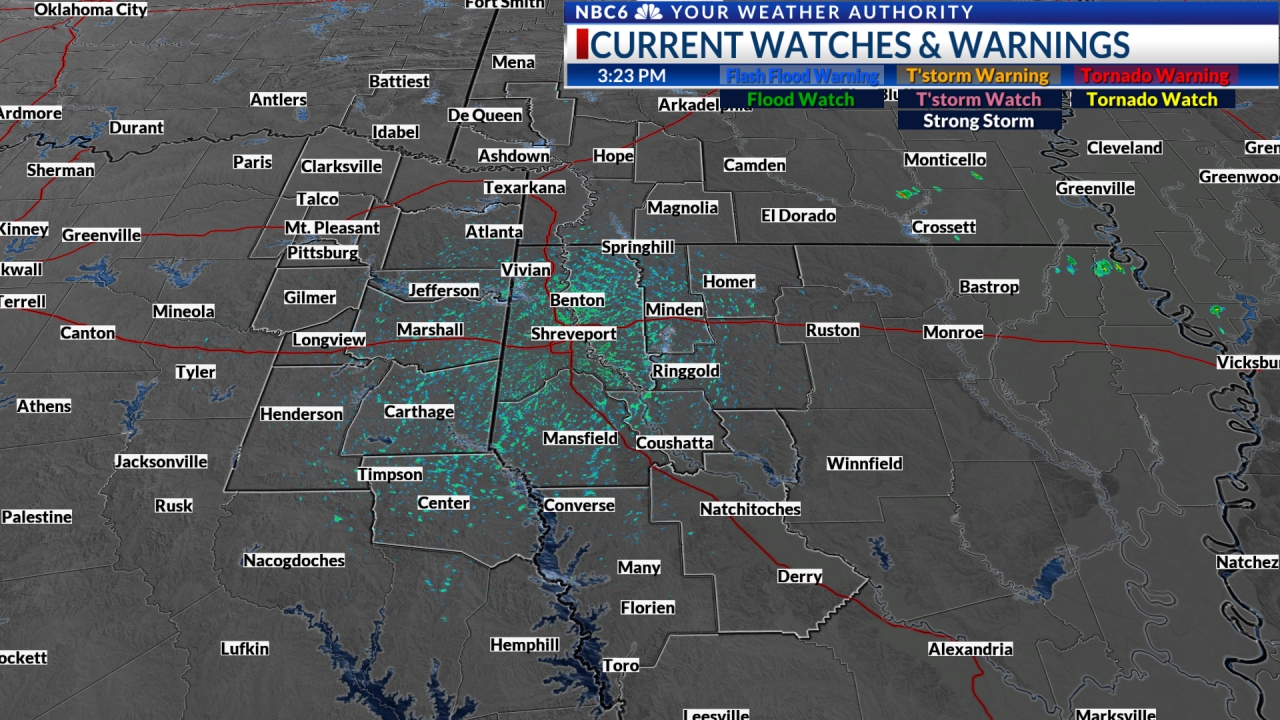
Update: Tornado Watch until 3am but risk decreasing. Flash flood risk to continue. The risk of tornadoes appears to be winding down across the ArkLaTex. An isolated tornado can not be ruled out, but the risk is looking rather low at this point. The more widespread concern will be the threat of heavy rain and the potential for additional flash flooding. We should see the rain gradually end late tonight into early Tuesday morning.
Radar shows that parts of NW LA and E TX have received two to over four inches of rain. Any additional rain overnight will only continue the threat of flash flooding.

More frequent updates with radar snapshots of storms we are watching here
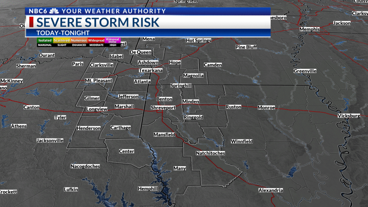
Thunderstorm risk and outlook: The Storm Prediction Center has issued an ‘Enhanced Risk’ outlook for severe thunderstorms for the entire ArkLaTex. This is a threat level of 3 on a 1 to 5 scale, 5 being the highest. This means numerous severe storms are possible, with a few intense thunderstorms.
Threats: The primary threat will be damaging wind gusts in excess of 60 miles per hour. There may be a few tornadoes, and quarter to golf-ball-sized hail, culminating in the risk of flash flooding as we may receive heavy rainfall as well.
Timing: Please note that the severe thunderstorms may arrive in 2 different waves today. The first wave may develop between noon and 3 p.m. in the warm air ahead of an approaching cold front. Scattered storms that develop during this time will be the ones most likely to produce large hail. This round may not impact everyone so don’t let your guard down as more storms are likely later in the day.
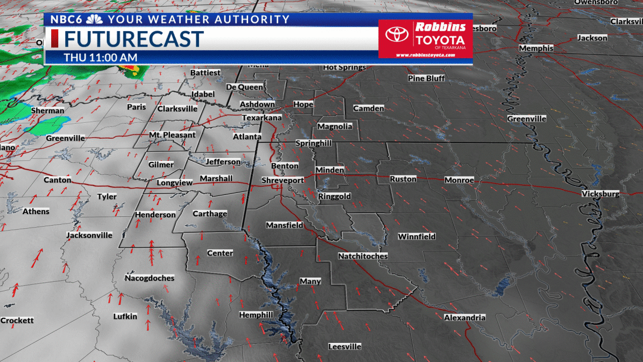
The potential later wave or storms will arrive around sunset and continue through late tonight with the arrival of the front. The line of thunderstorms that develops along the front will plow through the region bringing the highest threat for damaging straight-line wind gusts in excess of 60 miles per hour, as well as embedded tornadoes and flash flooding.
Rainfall accumulations are expected to be 1 to 2 inches, but isolated amounts of 3 to 4 inches will be possible. The ground is still soaked from the heavy rain last week so we are more prone to runoff into streets, creeks, and drainage areas. Flooded roads may make the late afternoon and evening commute hazardous. A Flood Watch is in effect through tonight.


Actions to take today: It is very important to abandon all mobile and manufactured homes this morning and find a sturdy shelter from the weather today. Similar severe weather setups in November and December did result in deaths and injuries in mobile homes.
Make sure you enable wireless emergency alerts on your smartphone to receive severe weather warnings.
Download our weather app and set your location, so you can receive alerts and warnings as storms near your area.
Get exclusive severe weather details on storms as they approach your area by downloading the Arklatex Weather Authority app, now available in the App Store and Google Play

Temperatures to cool throughout the week: Temperatures will be in the upper 60s with light rain and patchy fog this morning. Highs will be in the mid to upper 70s today. The cold front will gradually bring cooler weather this week as highs will be pleasant tomorrow and chilly by the end of the week. This will be our only threat of severe weather this week. Scattered showers may return by late in the upcoming weekend.

Stay connected with us on social media platform for instant update click here to join our Twitter, & Facebook
We are now on Telegram. Click here to join our channel (@TechiUpdate) and stay updated with the latest Technology headlines.
For all the latest For News Update Click Here